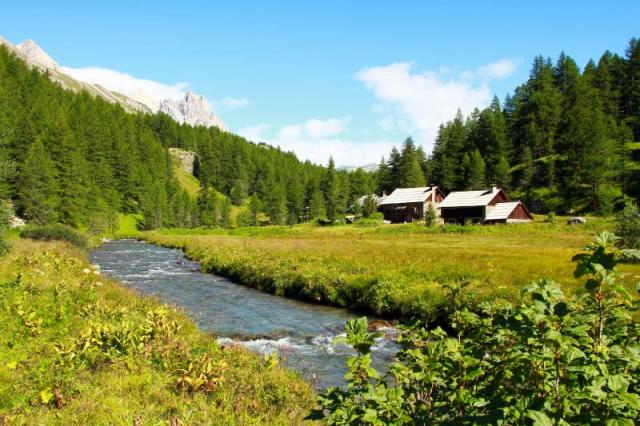
Starting from the centre of Névache cross the Clarée by the path over the bridge on the GR Pays du Tour du Thabor (l'Outre). At Pont du Rately continue along the right bank (without crossing the bridge) to the chalets of Foncouverte via the chalets of la Meuille. Then continue along the surfaced road after La Fruitière restaurant for 800 metres (lunch and refreshments are available). After crossing the bridge beneath the campsite, follow the path through the chalets of Rif Tord and Roche Noire to Refuge Laval.
(After taking the shuttle bus or car up to the car park in Laval, it's a 5-minute walk to the refuge, which you'll see below you on your left, nestling up against the rock. Vehicles must only be parked in the car park).
More information


