Compagnie des Refuges Clarée Thabor
Search for availability of lodges and refuges

6 days (5 nights): Tour around Thabor starting from Névache

Refuge Buffère - Chardonnet - Ricou - Laval - Drayères - Thabor - I Re Magi - Terzo Alpini
A little tour of Thabor...

step 1
From Névache to Refuge Buffère

see on map
Take the path on the right bank of the Clarée to Pont du Rately. A little further on, turn right onto the path that continues towards Fontcouverte and walk up to Refuge Buffère (1 hr 30).

BONUS: For a round trip from the refuge, head up Col de Buffère and take the sometimes steep path to the left that leads to Grand Area (2,869 m, 2 hrs). Enjoy magnificent panoramic views of the Cerces and Oisans.
Option: From Névache, turn left shortly after Pont de l'Outre and walk up to Lac de Cristol. Come back to the start of the valley, then follow the Côte Rouge path halfway up the north face of l’Echaillon to reach Refuge Buffère (4 hrs).
More information

Refuge Buffère

- 2076m
Departure arrival1600 m
Arrival altitude2076 m
Elevation+500m
Time1h30

step 2
Refuge Buffère to Refuge du Chardonnet

see on map
From Refuge Buffère, follow the path down towards La Souchère. On reaching the bottom of the valley, stay on the good trail running along the right bank. 500 metres further on, look out for a track that climbs to the left towards Refuge du Chardonnet (signposted). This joins the path leading up from Fontcouverte to the chalets of Laraux (1,954 m). Follow the path through to Refuge du Chardonnet (2 hrs 30).
Option: From Refuge Buffère, walk up Col de Buffère and follow the path to the right marked “la sente des grimpeurs” that joins Vallon de la Moulette without dropping down onto Chemin du Roy. Head up Vallon de la Moulette to Col de Rochenoire at 2,693 m (with some steep sections). Then walk down to Refuge du Chardonnet (3hrs 45).
BONUS: from Col de Buffère, a round trip to the summit of Grand Area, (2,869 m, 2 hrs), with a stunning 360° panorama.
More information

Refuge du Chardonnet

- 2227m
Departure arrival2076 m
Arrival altitude2230 m
Elevation+400m/-250m
Time2h30

step 3
Refuge du Chardonnet to Refuge Ricou

see on map
From Refuge du Chardonnet, cross the flat area to the west of the refuge to join the path leading down to Fontcouverte via the chalets of Queyrellin. Pass by La Fruitière restaurant (meals and refreshments) and cross the Clarée. The track leading up to Ricou turns left 20 metres after the bridge.
BONUS: From Refuge du Chardonnet, you can make a round trip to Col du Chardonnet at 2,638 m (+400 m, 3 hrs), before returning to Refuge de Ricou.
More information

Refuge de Ricou

- 2115m
Departure arrival2230 m
Arrival altitude2115 m
Elevation+250m/-350m
Time2h

step 4
Refuge Ricou to Refuge des Drayères or Refuge Laval

see on map
From Refuge Ricou, climb up to Chemin de Ronde (GR57A) (to the footpath junction, 2,291 m). Head north on Chemin de Ronde, which offers a magnificent vista of the Cerces range on the opposite bank. You pass beneath Lac de la Cula, then after a small pass (2,400 m), head back down to the hamlet of Laval (3 hrs 30) from where you can either reach Refuge Laval within 10 mins or Refuge des Drayères within 45 mins.
BONUS: from Chemin de Ronde climb to Lac Laramon and Lac du Serpent, 2,448 m (+1 hr 30).
More information

Refuge des Drayères

- 2180m

Refuge Laval

- 2010m
Departure arrival2115 m
Arrival altitude2180 m
Elevation+450m/-350m
Time3h45

step 5
From Refuge Laval or Refuge des Drayères to Refuge du Thabor or Granges de la Vallée Etroite

see on map
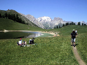
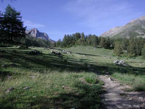
From Refuge Laval or Refuge des Drayères, follow the GR57 passing by Lac Rond, Lac des Muandes and over Col des Muandes, at 2,828 m (2 hrs). Follow the ridge of Roche du Chardonnet, cross Col de Valmeinier and pass under the north face of Roc de Valmeinier on the Maurienne side to reach Col de la Chapelle. From here a fairly firm track leads to the south face of Mont Thabor, where you'll join the classic route, taking you up to the summit at 3,178m (3 hrs). From the summit, make your way down to Col des Méandes following the usual route.

- To get to Refuge du Mont Thabor: From Col de Méandes (2,727 m), keep to the left (north) of Grand Séru to get down to Lac du Perron (2,450 m) and, roughly following the natural gradient to reach Col de Vallée Etroite (2,434 m), then Refuge du Mont Thabor (2 hrs from the summit).

- For Granges de la Vallée Etroite: From Col des Méandes, you can reach Refuge I Re Magi or Refuge Terzo Alpini via Vallon du Dîner To the south of Grand Séru.

NB: at the start of the season, the north-facing section between Col de Valmeinier and the summit of Mont Thabor can be dangerous if there is still snow (with icy, steep sections).

Option: You can shorten this leg by heading straight down to Vallée Étroite and the refuges of I Re Magi or Terzo Alpini from Col des Muandes ( a little-used path up to the footbridge, and then a busier one thereafter).
More information

Refuge I Re Magi

- 1760m

Refuge Terzo Alpini

- 1780m

Refuge du Thabor

- 2502m
Departure arrival2030 m
Arrival altitude1780 m
Elevation+1100m /-700m ou -1400m
Time7h30

step 6
From Refuge du Mont Thabor or Granges de la Vallée Etroite to Névache

see on map
- From Refuge du Mont Thabor, head To Col de Vallée Etroite and cross To the left To join the GR57. Go down into Vallée Etroite over easy grassy slopes, then a steeper, gullied section, followed by fairly flat stretches. Shortly after Pont de la Fonderie, veer up to the right. Then, turn left just before the Maison du Chamois along a path that is steep at first and leads around the Tête du Chien to reach Col du Vallon (2,645 m) on a good path. Come down the long yet little valley of Vallon towards Névache (6hrs 30).

From the Granges de la Vallée Etroite, take a beautiful, easy path up to the Col des Thures (2194m), then head down to Névache via the gently sloping grassy valley at the top and along the well-trodden winding path by the Clarée (Cheminées de Fée). You’ll then reach Roubion (3 hrs 30).
In summer, you can take the free shuttle bus back to Névache.
More information

Gite la Decouverte

- 1595m
Departure arrival1780 m
Arrival altitude1600 m
Elevation+700m ou +350m/-1600m ou -500m)
Time6h30 ou 3h30
Book your accommodation
for this hike
step 1
From Névache to Refuge Buffère
Refuge Buffère
step 2
Refuge Buffère to Refuge du Chardonnet
Refuge du Chardonnet
step 3
Refuge du Chardonnet to Refuge Ricou
Refuge de Ricou
step 4
Refuge Ricou to Refuge des Drayères or Refuge Laval
Refuge des Drayères
Refuge Laval
step 5
From Refuge Laval or Refuge des Drayères to Refuge du Thabor or Granges de la Vallée Etroite
Refuge I Re Magi
Refuge Terzo Alpini
Refuge du Thabor
step 6
From Refuge du Mont Thabor or Granges de la Vallée Etroite to Névache
Gite la Decouverte
Departure arrival1600 m
Arrival altitude3178 m
Elevation+250m à +1100m selon les étapes
Timede 1h30 à 7h30
DifficultyDifficulty Medium
Seasonin summer